
Landforms are shapes of the land on the Earth’s surface.
They are natural, not made by people.
They are valleys, mountains, plateaus, plains, deserts, rivers and hills.
These are a few special landforms in Australia.
The Three Sisters, New South Wales
The most famous part of the Blue Mountains in New South Wales is a rock formation known as The Three Sisters. It stands at Echo Point, Katoomba, 110 km west of Sydney. The group of three steep-sided sandstone pillars are Meehni (922 metres), Wimlah (918 metres) and Gunnedoo (906 metres).

The Three Sisters © Getty Images
The Blue Mountains was formed 200 million years ago as a big bay in the ocean, surrounded by high mountains. Over time the bay filled with sand and mud washed from the mountains. This was was pressed into a type of rock called sandstone. Pressure from deep inside the Earth slowly lifted up the land, and made a raised area of flat land called a plateau. Over millions of years, in places where the sandstone was cracked or weak, rain, wind and ice wore it away making wide valleys and narrow gorges surrounded by steep sandstone cliffs. This wearing away is known as erosion.
Read an Aboriginal peoples' legend of how the Three Sisters were formed.
http://www.bluemts.com.au/info/thingstodo/threesisters/
Wolfe Creek Crater, Western Australia.
Wolfe Creek crater was caused by a meteorite. © Getty Images
300,000 years ago Australia was hit by a huge meteorite weighing about 50,000 tonnes. It happened at Wolfe Creek in Western Australia on the edge of the Great Sandy Desert. The meteorite made a crater that is the second biggest in the whole world. It is 800 metres across, 60 metres deep, and is almost a circle in shape.
Legend according to Aboriginal people
The local Djaru people had known about the crater for thousands of years. Their legend from the Dreaming time, the time when the world was created, says that two giant rainbow serpents formed Sturt Creek and Wolfe Creek as they crossed the desert. The crater is the place where one of the serpents came up from inside the ground.
Europeans only discovered the crater in 1947. Today many tourists visit the Wolfe Creek Crater which is 90 kilometres south of Halls Creek in Western Australia.
The Twelve Apostles, Victoria
(There are just 7 still standing)
The Twelve Apostles are sea stacks (rock pillars) in the Great Southern Ocean along the coast of Port Campbell National Park, Victoria, west of Melbourne.
They are one of the beautiful sights tourists visit along the Great Ocean Road. There are seven limestone stacks standing just off the coast of Victoria and known as the Twelve Apostles. Some of the pillars are 65 metres tall but others are smaller. Slowly they are being destroyed by the pounding ocean waves which roll in every 10 to 16 seconds.

Only 7 of the 12 Apostles are still standing, the others have eroded away. © Getty Images
Ten to twenty million years ago the Twelve Apostles and the other rock formations in the area were part of the mainland. The cliffs along the coast were made of soft limestone, and overtime the waves gradually formed caves in the cliff face. Later the caves were eroded (washed away) to become arches, then the arches broke down to become columns. Today the cliffs are still being eroded at a rate of 2 centimetres each year.
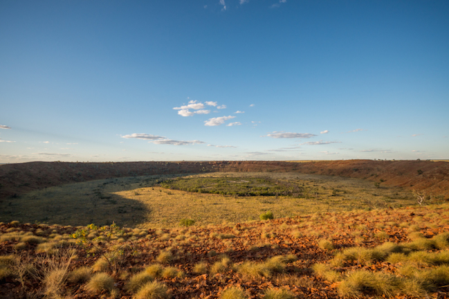
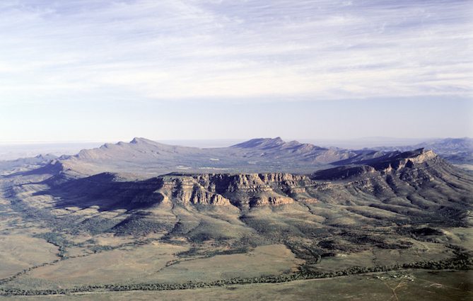
Wilpena Pound, Flinders Ranges, South Australia
Wilpena Pound is a saucer or basin- shaped plain surrounded by cliffs in the Flinders Ranges. It is 429 km north of Adelaide. It looks like it could be a crater, but it was not made by a meteorite or a volcano.
Wilpena Pound was originally a huge dome of quartz rock which was pushed up by the Earth’s movements 650 million years ago. The plain covers an area of 83 square kilometres. The inside of the basin is 11 kilometres long by 8 kilometres wide. The floor of the basin is 200 metres higher than the country around it.
It’s a great place for bushwalking and teems with wildlife including emus, kangaroos, much bird life and the threatened yellow footed rock wallaby.
The traditional landowners, the Adnyamathanha people, call Wilpena Pound ‘Ikara’ or meeting place, but it is possible that ‘Wilpena’ is an older Aboriginal word meaning ‘place of bent fingers’ or ‘cupped hand’. A pound is a place where animals are kept, and white farmers used to graze cattle in Wilpena Pound.
Wilpena Pound in South Australia ©
Wave Rock, Western Australia
Wave Rock is a rock wall shaped like a giant surf wave that’s about to break and crash onto the bush below.

Wave Rock, Western Australia © Getty Images
It is 15 metres high and 110 metres long and is made of granite. The rock was formed 2 700 million years ago. The shape was made by weathering and erosion (wearing away) by the sun, wind, rain and springs of water that run in the wetter months. This erosion wore away the rock at the base, leaving a curved overhang.
Wave Rock is coloured with streaks of red, brown, yellow and grey. These colours are stains from chemicals in the rock which are dissolved in the water that runs down the rock face in the rainy months.
Devil’s Marbles (Karlu Karlu), Northen Territory
About 1 500 million years ago, 114 km south of Tennant Creek and 390 km north of Alice Springs, molten rock (lava) formed domes under the earth. As the lava cooled it hardened, forming granite rock. It shrank and cracked into big square blocks. These pieces were eroded (worn away) by wind and rain, and by the very hot daytime and very cold night-time temperatures. Erosion eventually shaped the enormous red coloured, rounded boulders that people call Devil’s Marbles. Some of the boulders are massive, up to 7 metres high. Others are tiny, but they average 4 metres high and between 13 and 33 metres wide.
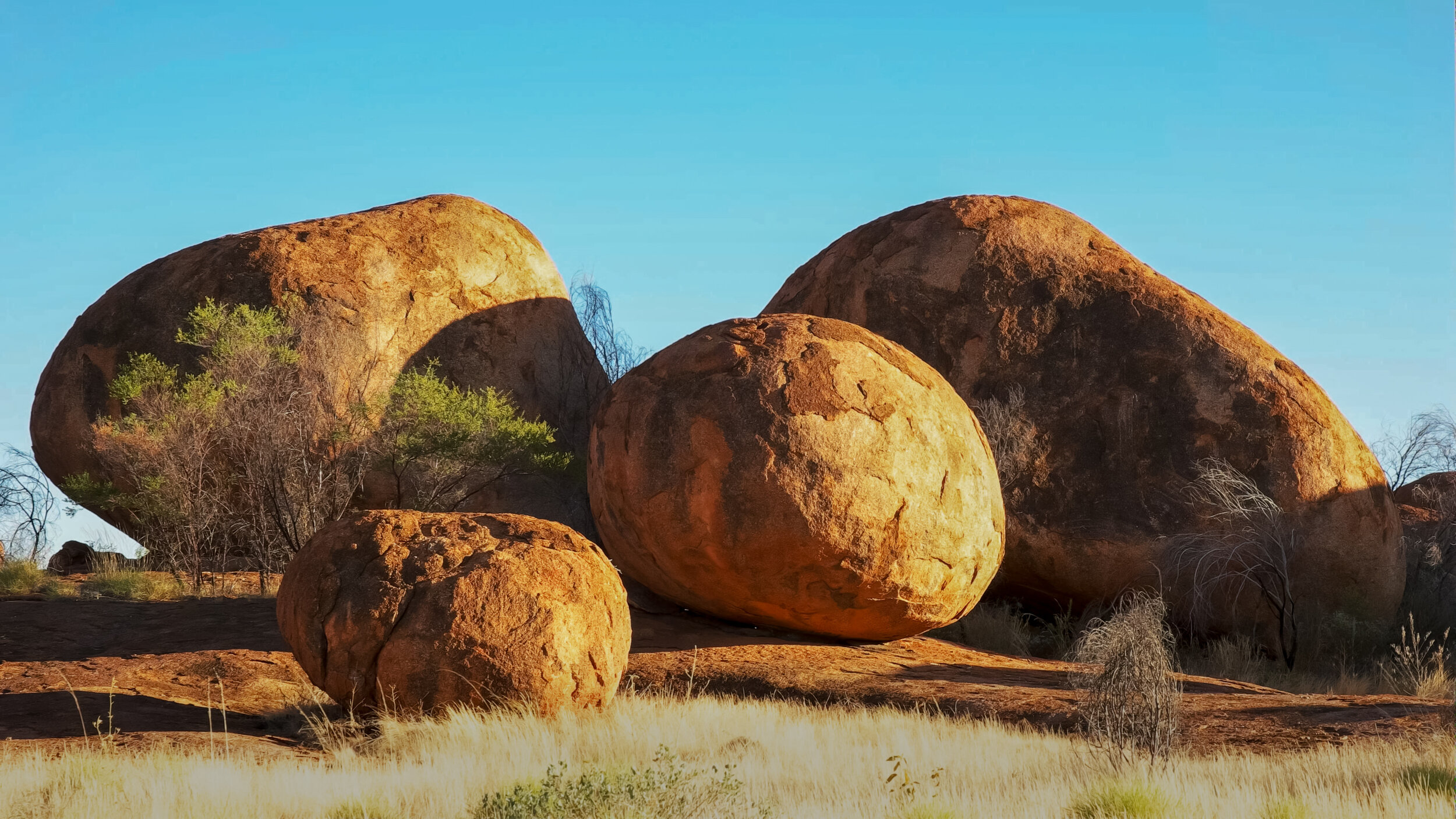
One group of the Karlu Karlu rock formation sometimes called the Devil’s Marbles. ©Getty
The site is known as Karlu Karlu to the land’s Aboriginal traditional owners. Although Karlu Karlu is within country belonging to Alyawarre people, Kayteye, Warumunga and Warlpiri people also have spiritual connections and responsibilities for the area. There are many Dreaming stories about the rocks. For Aboriginal peoples the Dreaming is the time when the world was created.
Uluru (was once called Ayers Rock)

Uluru is a UNESCO World Heritage Site. It is a sacred place to the Anangu people, its Traditional Owners.© iStock
Uluru is the Aboriginal name for one of the natural wonders of the world, a large rock formation located close to the exact centre of Australia.
Kata Tjuta National Park includes both Uluru and another unique rock feature, Kata Tjuta, which used to be known as the Olgas. Kata Tjuta are about 50km away from Uluru, and are part of the same original mountain range.
Both Uluru and Kata Tjuta are sacred for the Aboriginal people of the area. Ancient Aboriginal paintings can be seen in caves in Uluru. These paintings tell the story of the Dreaming, the Aboriginal story of how the world was formed. Uluru is now listed as a World Heritage site, recognising its importance and uniqueness.
About 500 million years ago it was part of the ocean floor. There is little or no vegetation on the rock. Uluru was named Ayers Rock in 1873 by European explorers, after the Premier of South Australia, Sir Henry Ayers. The rock resumed its original name in 1985 when the land was returned to its traditional owners, the Anangu, who now own and operate the Kata Tjuta National Park, of which Uluru is part.
The Aboriginal peoples of Australia tell, in a legend, that Uluru was created as a result of a great battle.
Two tribes of ancient spirits were invited to a feast but were distracted by Lizard Women and failed to turn up. This slight to the hosts resulted in battle and many were slain. Uluru rose up as a mark of the grief of the land at this bloodshed.
The word means ‘island mountain’. Uluru is on a dry desert plain in the Northern Territory. It is 2.4km (1.5 miles) long and 1.6km (1 mile) wide and rises up about 348 metres above the surrounding land. It covers 3.33 square km (1.29 square miles) of land. It extends deep below the ground surface, exactly how far is not known.
Uluru is an inselberg
Uluru is often called a monolith, but is in fact an inselberg, which is a hard rock remainder of a mountain after the softer part has eroded away. An inselberg is an isolated hill or small mountain that stands out from a surrounding flat plain.
Read facts about Uluru
https://uluru-australia.com/about-uluru/uluru-facts/